
The walk at a glance
Walkers: Jess, Lora, Leela, Saira, James, Marley, Ali, Emily
Distance: 9 miles
Settlements: Hadleigh, Leigh-on-Sea, Westcliffe, Chalkwell, Southend-on-Sea
Places of Interest: Hadleigh Castle, Drift, Graveyard of Lost Species, Leigh-on-Sea Old Town, Leigh Heritage Centre and Museum, Grouts, Focal Point Gallery, Southend Pier
Terrain: Mostly flat
Weather Conditions: Overcast, Blue skies and sunshine
Water Sites: Thames Estuary, Prittle Brook
Mood: Jubilant
A question to walk with
How does the estuary serve as a bridge between different social classes and ethnic backgrounds? How do we map the 'Blue Steps' in a way that reflects the coastal diversity of Southend and Leigh?
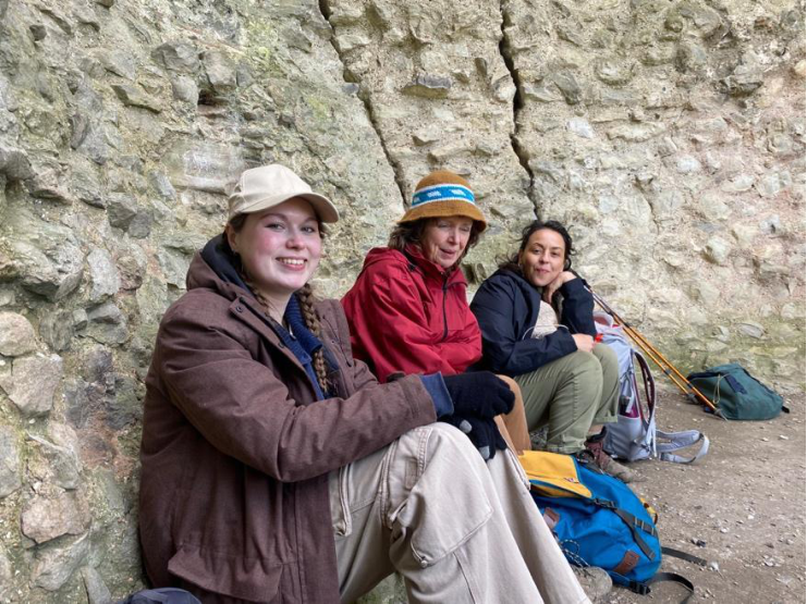
A few of us gather at Oak Wood Park where we wait for others to arrive. Today we are going to be joined by Ali, a walking artist and director of Kinetika, James, an artist and cultural development officer at Essex Council and Emily who works as a Bluespaces Officer at Essex and Suffolk Rivers Trust. I’m sure the day will be generative and inspiring, and we’re excited to end at the sea.
Setting off, we head towards Belfairs Nature Reserve where we seek out Prittle Brook. The Prittle Brook, a smaller but significant watercourse that threads through the urbanising edge of the estuary. The brook flows from inland Essex through places like Hadleigh and Leigh before joining the Roach and eventually the sea.
Here, the scale shifts. The estuary’s wide openness contracts into a narrower corridor. The brook is partially hidden - culverted in places, bordered by roads and housing. Yet it still carries the same tidal logic downstream, connecting inland and coastal systems. Walking alongside the Prittle Brook, the idea of co-existence becomes more complex. This is not a remote marshland but a lived-in, everyday environment. The brook runs through parks, under roads, behind houses. It is both visible and obscured.
This continuity suggests that lived narratives are not confined to obvious “heritage” sites. They persist in quieter ways - in the alignment of paths, in flood defences, in the shaping of urban greenways. The Prittle Brook Greenway, for example, transforms a watercourse into a linear public route, but in doing so, it also reshapes how the brook is experienced: from working water to managed landscape.
This transformation raises another question: what is lost when lived practices are replaced by recreational ones?
As we walk, we talk about our various interests and projects. We talk about our favourite places and the weather, about history and heritage, water and wildlife, Essex lore, culture, music, trails, and festivals. We skim around Hadleigh town and into the country park. The trail threads through these spaces in a way that feels indirect. It skirts edges, avoids centres, and redirects around private land. This routing reflects a deeper structure: the estuary is not fully accessible because it is not fully ownable.
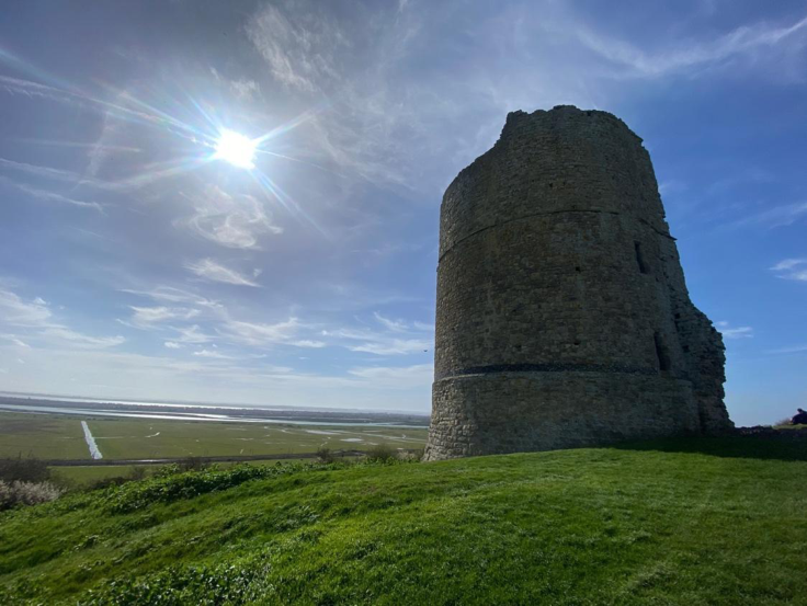
We zigzag through the country park, climbing up and descending down, taking in the sweeping estuary views. Soon we arrive at the castle. We have lunch inside the ruins, the clouds dissipate and the sun illuminates everything. Crowds of birds pass through the sky.
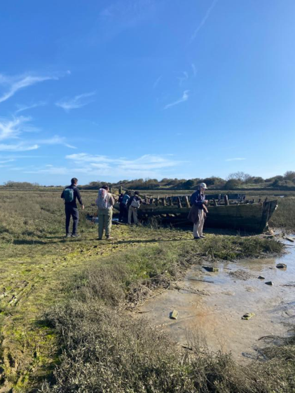
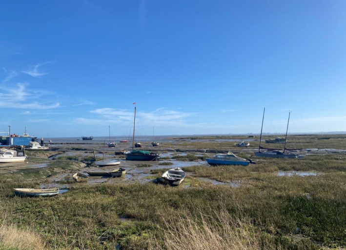
After lunch, we head to Leigh-on-Sea Old Town. The town’s identity is closely tied to its fishing heritage, particularly cockling. Boats cluster along the foreshore, and the tidal flats stretch wide at low water. This is one of the clearest points where lived narrative and landscape align visibly. We stop off at Drift for iced drinks. This is also where we meet Marley. Shortly after, we take a detour to visit Graveyard of Lost Species, a boat slowly sinking into the Essex mud flats bearing the names of the disappeared that haunt the Thames Estuary. The artwork is dedicated to the people of Leigh and Southend-on-Sea. Its air has gotten so hot and still.
After a wander around, we head back to Leigh. Along the narrow lanes and along the estuary, small wooden cockle boats still head out daily, continuing a centuries-old industry that made the town famous. Fishing - especially for cockles and shrimp - remains part of the local identity, with fresh catches often sold right by the quay. The mix of working fishing culture, weathered huts, and scenic views over the Thames Estuary gives Old Town its distinctive character and enduring connection to the sea.
Fishing communities engaged with the estuary as a site of labour. The mud, the tide, the unpredictability - these were not obstacles but conditions of work. This is not just a route through landscape; it is a route through working histories - of fishing, mud, salt, and labour - that continue to structure how the estuary is inhabited.
Walking the trail, those same conditions are encountered differently. Mud becomes an inconvenience. Tide becomes scenery. Yet traces of the older relationship remain.
We visit Leigh Heritage Centre & Museum, home to a photographic display tracing Leigh's local history, and a treasure trove for those connected to Leigh-on-Sea. We step into a fisherman’s cottage and glimpse into the lives of fishing families.
They possess traces of fishing practices - hauling nets, and wire baskets. Fishing persists today, but it coexists with tourism, leisure, and residential life. The estuary is no longer solely a working environment; it is also a cultural and recreational one.
Walking into Leigh, the trail merges with streets, promenades, and the broader urban fabric. The sense of the path as a distinct line dissolves. Yet the estuary remains present - visible, audible, and shaping the space.
Reflecting on this stretch of the Saffron Trail, it becomes clear that “lived data” cannot be reduced to a single form. It is not just what is mapped, but what is remembered, repeated, and embedded in the landscape.
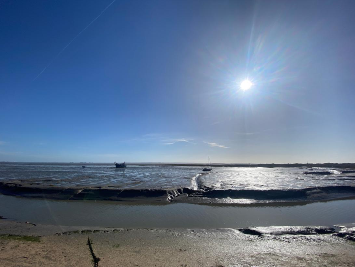
It looks like: boats resting in mud, marking tidal rhythms, informal paths leading to the water’s edge, drainage systems that reveal former marshland, culverted streams that still carry estuarine connections. These are not official markers, but they are legible if you know how to read them.
The stories of fishing and marshland communities shape the trail not by being explicitly told, but by structuring the landscape through which the trail passes. The path follows, intersects, and occasionally obscures these stories, but it does not replace them.
In this sense, the Saffron Trail is not just a route across Essex. It is a way of encountering a layered estuarine system - one where human and non-human histories are entangled, where water dictates movement, and where the most important data is often the least visible.
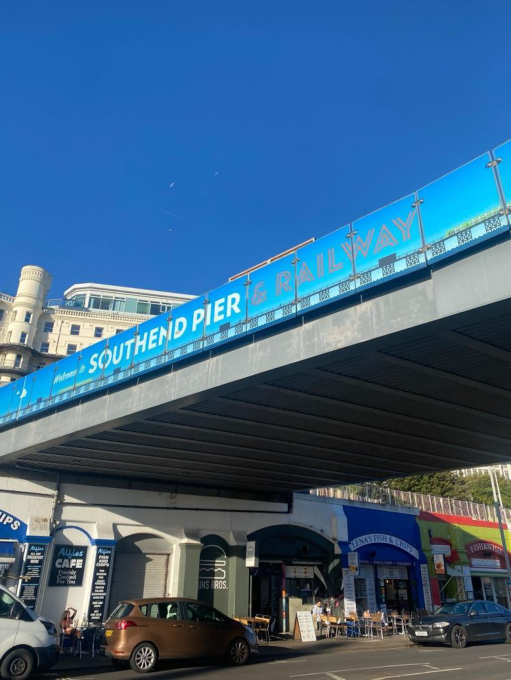
This final section of the trail is defined by proximity to water - unlike earlier stretches, where rivers were glimpsed, crossed, or followed loosely, here the estuary becomes continuous. The path runs alongside it, almost insistently, as if drawing the entire route toward its endpoint at Southend Pier - the formal start or finish of the trail depending on direction.
But the question now is not where the trail goes. It is what the trail has become.
Walking out of Leigh, the ground is firm - pavement, promenade, sea wall. After miles of mud, fields, woodland, and unstable stiles, this solidity feels almost unnatural. The path is no longer negotiated; it is given. Cyclists pass, dogs move freely, and people sit facing the water. The trail merges into everyday life.
And yet, the estuary continues to resist full containment. At low tide, the water withdraws dramatically, exposing wide mudflats that stretch far beyond the visible edge of the path. These flats are not empty. They are active zones - feeding grounds for birds, sediment systems shaped by currents, spaces that exist only temporarily before being reclaimed by the tide.
Looking back across the seventy miles, this moment reframes everything. The inland sections - the farmland, the hedgerows, the rivers - now feel like precursors to this tidal condition. The estuary is not just an endpoint; it is a culmination of processes that have been present, in quieter forms, throughout the walk.
The path continues eastward, passing through Chalkwell, where the boundary between town and coast becomes increasingly blurred. Here, the trail is indistinguishable from the seafront promenade. People move along it without reference to the Saffron Trail itself. There are no visible markers insisting on its identity. It has dissolved into shared infrastructure.
This raises the central provocation: is the Saffron Trail a path, a project, or a shared asset?
As a path, it is clearly defined - waymarked, mapped, measurable. It runs for approximately 70 miles across Essex, connecting inland towns to the coast. But walking this final section, that definition feels insufficient. The path is no longer distinct. It has merged with other systems - urban, social, ecological.
As a project, the trail reflects intention. It was conceived, designed, and implemented as a long-distance route, stitching together different landscapes into a coherent line. But that coherence is uneven. Earlier in the walk, the trail felt fragmented - interrupted by private land, diverted around obstacles, dependent on permissions. The project is visible in its construction, in its stitching.
Here, at the coast, that stitching becomes invisible. The trail no longer feels constructed; it feels absorbed.
Perhaps it is only here that the idea of the trail as a shared cultural treasure becomes fully legible.
The promenade is used by everyone: walkers, runners, cyclists, families, fishermen. Access is not conditional in the same way it was across farmland or estate land. There are no stiles, no gates, no signs warning of livestock. Movement is open, continuous, and collective.
But even this sense of shared space is partial.
The estuary itself remains beyond full access. You can walk alongside it, but not into it - at least not without consequence. The mud is unstable, the tide unpredictable. Non-human species occupy this space more fully than humans do. Birds move across the flats, fish navigate tidal channels, invertebrates live within the sediment.
If the inland sections of the trail revealed the limits of human access through ownership, the estuary reveals limits through ecology. Walking toward Westcliff-on-Sea, the density of the built environment increases. The path becomes busier, noisier. Arcades, benches, railings - all elements of designed public space -frame the movement. The trail is now fully embedded within the town.
And yet, looking back - physically turning to face the direction you have come from - the continuity of the estuary remains. The water connects Hullbridge, the River Crouch, the Roach, and the Thames beyond. The inland journey is not separate from this coastal edge; it is part of a larger hydrological system.
This is where the idea of the trail shifts most significantly.
It is not just a line across land. It is a way of encountering connections - between inland and coast, between human and non-human systems, between different forms of ownership and access.
Reaching Southend-on-Sea, the endpoint becomes visible: the long, linear extension of Southend Pier projecting into the estuary. It is an exaggerated version of the trail itself - a line extending into space, marking direction, asserting presence.
But unlike the inland trail, the pier is singular and fixed. It does not negotiate; it extends.
Ethnically and culturally, Southend reflects broader patterns of coastal towns –seasonal visitors, migrant labour, and day-trippers from London - the estuary edge becomes a point of encounter.
Standing at this point, the question returns: what is the Saffron Trail?
It is not only a path. A path implies clarity, continuity, and singular purpose. The Saffron Trail is too fragmented, too varied, too contingent for that.
It is not only a project. A project implies design, intention, and completion. But the trail is ongoing - shaped by changing landscapes, shifting access, and evolving uses.
It comes closest, perhaps, to being a shared asset - but even this is incomplete. The sharing is uneven. Some sections are open and collective; others are restricted and conditional. Some are shaped by human use; others by ecological processes that do not accommodate human presence.
What the seventy miles ultimately reveal is that the trail is a composite.
It is:
● a legal line through private land
● a historical construct linking places and narratives
● an ecological corridor intersecting rivers, woodlands, and estuaries
● a social space that expands and contracts depending on context
Walking from Eastwood to Southend makes this visible in its most distilled form. The trail dissolves into the seafront, becoming indistinguishable from everyday movement. And yet, the estuary continues alongside it - dynamic, inaccessible, shared by species that do not follow paths.
Looking back, the Saffron Trail is best understood not as a single entity, but as a negotiation.
Between land and water. Between ownership and access. Between human intention and ecological process.
It is a path, but only sometimes. A project, but never fully complete. A shared asset, but unevenly distributed.
And in its final stretch - where it meets the open estuary - it becomes something else entirely: a line that reveals how all of these conditions overlap, without ever fully resolving into one.