The walk at a glance
Walkers: Jess, Lora, Leela, and Saira
Distance: 9 miles
Settlements: Danbury, East Hanningfield
Terrain: Uphill
Weather Conditions: Blue skies and sunshine, overcast
Water Sites: River Chelmer, Danbury Spring
Mood: Determined
A question to walk with
How do historic water systems inform our modern climate justice lens? How do we bridge the gap between heritage and future resilience?
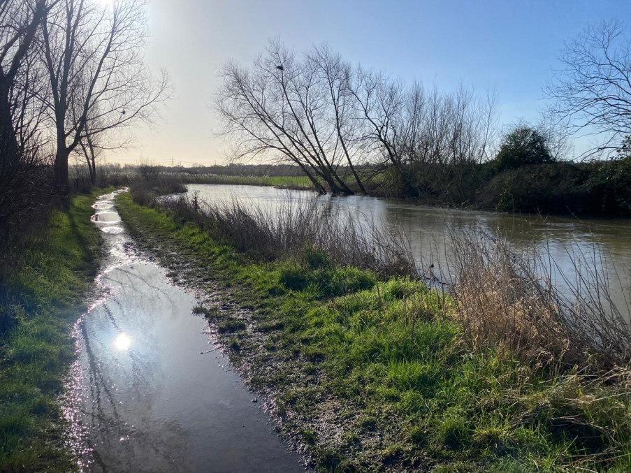
We start this stretch of the Saffron Trail at Chelmer Village, on the edge of what feels like very typical modern development- housing estates, roads, and bits of managed green space. It doesn’t take long, though, before that gives way to something quieter. The sky is blue and the sun is out – it feels like the start of spring. The path begins to pull us out of the planned environment and into a landscape that feels older and less controlled.
Early on, the River Chelmer comes into view and sticks with us for a while. It’s not dramatic, but it’s steady and present. Walking alongside it, I notice the way the banks dip, how the ground gets softer in patches, reeds shifting in the wind. It’s a reminder that this landscape is shaped by water in ways that aren’t always obvious.
The path beside the river is flooded, so we veer off and overshoot, we cross a field and meet the river once again.
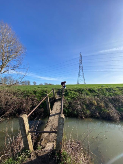
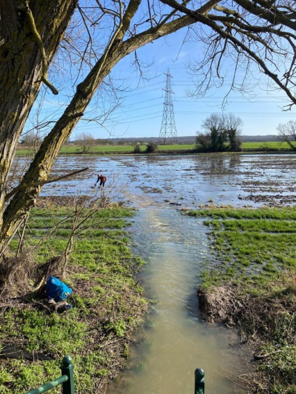
We again encounter a flooded path, as the others decide to skim the edges under the Chelmsford bypass, I take off my boots and walk across. The water is icy cold but jolts me back into existence. We gather on the other side, unsure of what the day will hold. We reach a stepped footbridge, and as we climb to the top, we look out onto sweeping views of the River Chelmer. At the end of the bridge, we look down onto a flooded farm, the footpath has transformed into a waterway. We have a quick vote and decide to push on, to brave the water and soft mud, and to reach the other side, hopeful that it will be the first and last obstacle.
Jess and I wade our way through the water, as Leela and Lora skim its edges. I think about the idea of historic water systems, especially places like the Danbury Spring further along the trail network. Before large-scale infrastructure, water here would have come from local sources - springs, wells, streams. That meant people had a direct relationship with where their water came from. You couldn’t ignore it or take it for granted in the same way we often do now.
Today, that relationship feels much more distant. Water is something that arrives through pipes, managed by systems we don’t often see. Not far from this route is the Hanningfield Reservoir, which is a good example of that shift. It’s a huge, engineered solution - designed to store and supply water at scale. It works, but it also completely changes the landscape and disconnects people from the source.
As we move further along the path, away from the river and into more open farmland, the contrast became clearer. The fields are divided by hedgerows that go back centuries, and the footpaths cut across them in ways that feel quite direct - like they’ve been used and reused over a long time rather than carefully designed.
There’s something about walking through this kind of terrain that makes you more aware of how land and water are linked. We start to notice slight changes in elevation, where water might collect, how the ground drains. These are small details, but they would have mattered more when water systems were local and visible.
Thinking about climate justice in this context, it’s not just about the environment in a general sense - it’s about access and control. Historically, water wasn’t equally available to everyone. Where you lived, your social position, even your physical ability to collect it - all of that mattered. So those older systems weren’t necessarily “better,” but they were more obvious. You could see the inequalities.
Modern systems aim to provide water more evenly, which is important, but they come with their own issues. Large-scale infrastructure like reservoirs can have environmental impacts and often involve decisions that affect some communities more than others. And because everything is hidden, it’s easier to forget those trade-offs.
We cross into private land where we are hemmed into narrow paths divided by wire fences, it feels hostile. Lora picks off and hands us shepherd’s purse which we chew on as we move through the land. Unfriendly signs tell us where to walk, and leave us feeling annoyed.
We cut through Blakes Wood. Blake’s Wood is an ancient woodland on a sloping site of 100 acres of clear streams and valleys, covered primarily with oaks, chestnut and coppiced hornbeam. It is notable for its recovery from the severe damage caused by the Great Storm of 1987. Several photographs show trees that were blown down more than 25 years ago, yet managed to keep a roothold and recover, with their branches gradually taking on the role of the trunk. I remember an oral history I listened to at Essex Records Office. A female conservation officer, who moved to Essex to help with the restoration of the woods spoke of her experiences and connection to land she was not from. There are stories everywhere.
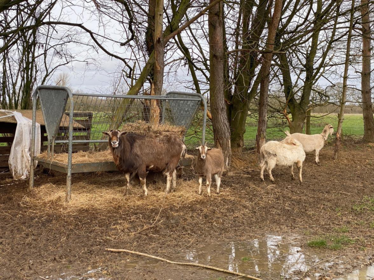
The sky turns grey and weariness sets in. We’ve been walking for hours, slowed down by mud and water. As the path enters Danbury village, the transition from rural to semi-urban is subtle but significant. Water remains a presence, though now largely managed. Old channels have been integrated into gardens, parks, and drainage systems. The historic spring, once a lifeline, is now a heritage site. But it retains an instructive value: it demonstrates how heritage infrastructure can inform contemporary resilience strategies. By mapping historic water flows and overlaying them with modern flood zones, planners and communities can anticipate risk and identify potential interventions - restoring channels, reactivating ponds, or enhancing wetlands for both ecological and social benefit. In Danbury, we have a hot cup of tea and eat our sandwiches before setting off again, through muddy fields and woods, and across water. We pass sheep and chickens and goats.
Approaching East Hanningfield, the landscape starts to feel more settled again. It’s a small village, with a long history, and you can sense that in the layout - older buildings, narrower roads, a different rhythm compared to where the walk started. Even if you don’t see them directly, you know there would have been wells, springs, and other local water sources that supported the community before modern supply systems were introduced.
This is where the question of bridging heritage and future resilience feels most relevant. It’s not about going back to using springs instead of reservoirs - that wouldn’t be practical or fair. But there’s something to learn from how visible and local those systems were. People understood their limits in a more immediate way.
Maybe part of building resilience now is about recovering some of that awareness, even within modern systems. Making water infrastructure more visible, thinking more locally where possible, and recognising that access to resources is still uneven - even if it’s less obvious.
By the time we reach East Hanningfield, the walk doesn’t feel like it has given a clear answer. The landscape isn’t just scenery - it’s a record of different ways of managing water over time. Rivers, springs, reservoirs - they’re all part of the same story, just at different scales.
It’s past 4pm. If we push on, we will be walking in the dark. We will also encounter a dangerous crossing. We decide to call it a day and book a taxi to pick us up from outside Vita Bella, where a stream of glamorously dressed men and women are emerging. A birthday party?
Walking that route makes those connections easier to see. And once you notice them, it’s hard not to start asking how the systems we rely on now could be made more transparent, and more fair, in the future.