The walk at a glance
Walkers: Jess, Lora, Leela, Saira, and Anisha
Distance: 8.82 miles
Settlements: Broomfield, Melbourne, Chelmsford, Chelmer Village
Places of Interest: Chelmsford Town Centre, Admiral Park, Central Park, Museum of Chelmsford, Essex Record Office
Terrain: Mostly flat
Weather Conditions: Blue skies and sunshine - overcast, Rainy
Water Sites: River Chelmer, River Can
Mood: Determined
A question to walk with
How do historic water systems inform our modern climate justice lens? How do we bridge the gap between heritage and future resilience?
Of all our walks we have completed so far, this walk, to our surprise, was the most challenging. We thought it would be straightforward, easy even. We are joined this time by another member of our team Anisha, a visual designer and illustrator from Kerala. Water is all around, we see it, we feel and hear it. It is the focus of many of our conversations; we encounter it, in a strange, visceral way.
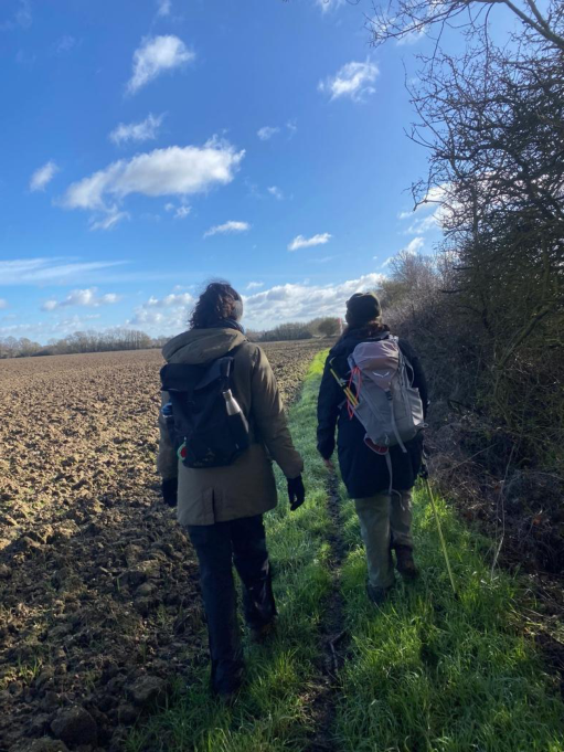
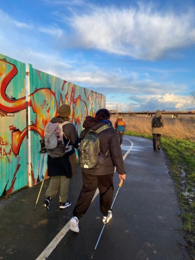
We gather in the church garden at Great Waltham, the skies above are blue, and the sun is out. It’s the first time the sun has made an appearance during our walks and we are in positive spirits. We quickly leave behind the church and clustered houses as the Saffron Trail slips once again into open countryside. The land here feels quieter than the previous section - less obviously shaped by dramatic floodplain crossings, but still deeply structured by water. A small tributary, the Walthambury Brook, threads through the parish, feeding into the larger system that will soon dominate the walk: the Rivers Can and Chelmer.
At first, the route moves through farmland and hedgerows, gently undulating but largely flat. The ground holds a residual dampness, a reminder that this is still a low-lying landscape, even when water is not immediately visible. The path is legible, firm enough to walk with ease, and yet there is a sense that this stability is conditional. The further south we move, the more the terrain begins to fold into the wider river system described in this section of the trail—a landscape “defined by the rivers Can and Chelmer,” even when they are not yet in sight. Broomfield Hospital is visible from a distance. I wonder what nature connection and creative health activities the trail could lend itself to for those working, visiting or staying at the hospital. All around are skies and open land. An expansiveness that is felt internally.
Soon, the weather changes. The sky fades to a familiar shade of grey and we decide to have lunch on a picnic table in a small wood near Melbourne. We share tamarind sweets, and goji berries, and other delicious snacks near Melbourne. We talk about all sorts of things: water, walking, music, food. The trail as a generator of connective speech – rosehip rasam, the backwaters of Kerala, collective design and dreams of shared futures.
We set off again, fields give way to wider margins, hedgerows loosen, and the presence of water becomes perceptible before it becomes visible. There is a subtle shift in vegetation, a thickening of grasses, a softness underfoot that suggests proximity to something larger. Then, almost without warning, the river reveals itself - not as a singular feature, but as a network.
We reach the confluence of the River Can and the River Wid. The water moves fast, carrying silt and reflections of overhanging branches, and beneath the surface, fish - roach, perch, bream - move through the current
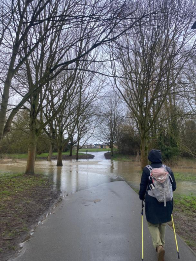
Here, the trail changes character. It is no longer simply a path across fields, but a river walk, one that draws you into the edges of an urban landscape while keeping you anchored to water. The route leads into Admirals Park, where the river is framed, managed, and made accessible. The path is flooded. The river has disrupted the path entirely, forcing us into it - cold, wet, uncertain.
As the path reappears, we continue, our feet swimming in our boots, to Central Park. Even in the park, the river carries traces of variability. Its level shifts, its banks soften, and the width of its channel hints at moments when it exceeds these boundaries. Walking alongside it, there is a sense that the landscape has been designed to accommodate water - to give it space, to absorb its fluctuations - rather than to exclude it entirely. This is not the rigid containment of engineered flood defences, but something closer to negotiation. At the park, Lora bumps into a friend, a South Asian musician, and warns her that the path ahead is flooded. She casually says, she’ll just have to take off her shoes, as there’s no way she’s walking all the way around.
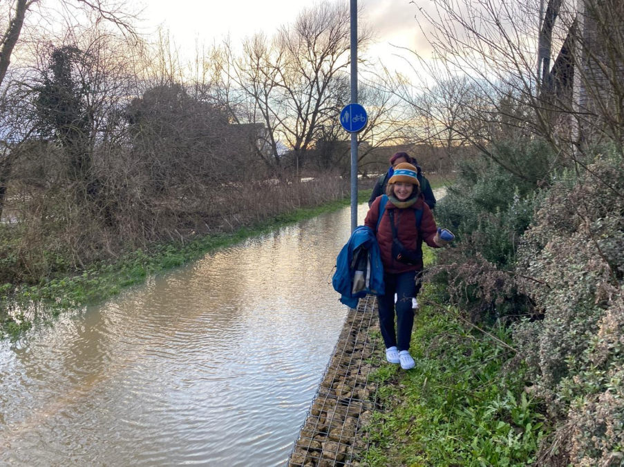
We take a detour at central park and walk into town, where we buy dry shoes and dry socks from Sports Direct. We change into them and then enjoy hot drinks in a nearby café before heading reluctantly on towards Chelmer Village, along the river Can. Another path is flooded up ahead, so we climb around a fence and carry on over the elevated banks.
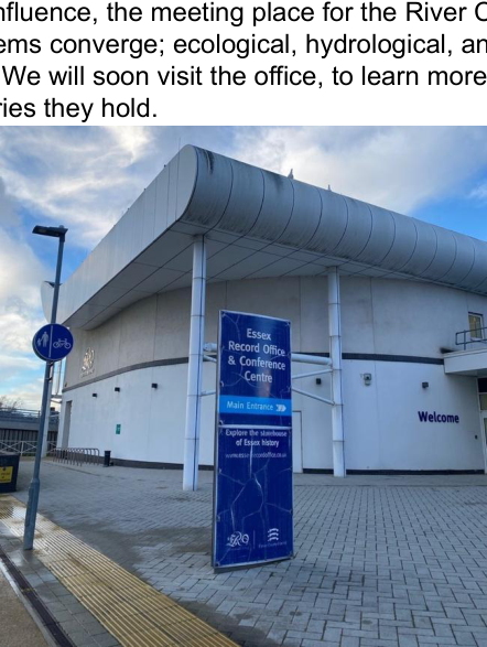
We reach another confluence, the meeting place for the River Can and River Cam. It is a place where systems converge; ecological, hydrological, and historical. We pass Essex Record Office. We will soon visit the office, to learn more about the lands we pass through and stories they hold.
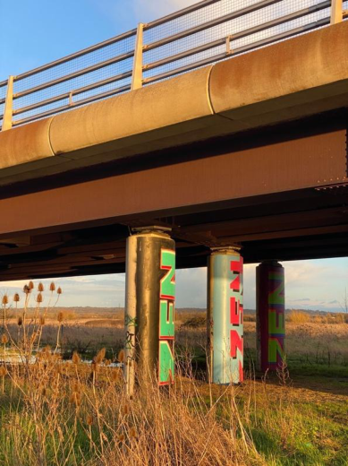
The walk continues along the Chelmer, tracing its movement through Chelmsford. There is a strange oscillation between rural and urban, between managed and organic. One moment, the path runs alongside open green space; the next, it passes beneath bridges, including the broad span of the A12 Chelmer Bridge, where the scale of infrastructure briefly overshadows the river itself. And yet, even here, the water persists, moving steadily beneath the structures built around it.
The path that runs under the bridge is flooded. We decide to stop short of the end point. Mud caked again. The river water that covered our feet and ankles has now dried. The evening sun has reappeared. We say our goodbyes in the shadow of the A12. As I head towards Chelmer Village where I will be spending the night, the memory of walking through floodwater lingers, reframing what is seen.
The question returns: how do historic water systems inform our modern climate justice lens?
In this section, the answer feels embedded in the design of the landscape itself. The rivers Can and Chelmer have long shaped settlement patterns, agriculture, and movement through this region. Their confluence marks not just a geographical point, but a historical one - where water has been both a resource and a constraint. The presence of parks, managed riverbanks, and accessible pathways suggests an attempt to integrate these systems into contemporary life.
But there is a tension here.
Modern interventions - parks, bridges, defined paths - create the impression that water has been stabilised, rendered predictable. Yet the very need for these interventions points to the opposite: that water remains dynamic, capable of exceeding its bounds. The earlier experience of flooding makes this visible. It suggests that what appears controlled is, in reality, contingent.
Walking along the riverbank, it becomes clear that bridging the gap between heritage and future resilience is not about choosing between past and present, but about recognising their overlap. Historic water systems in this landscape - whether monastic fishponds further upstream or the natural floodplains of the Chelmer - were based on an understanding of water as something to live with. Contemporary systems, even when more engineered, still rely on that same principle, whether acknowledged or not.
The difference lies in how visible that relationship is.
In the park, water is aesthetic, recreational, contained within landscaped edges. But just beyond those edges, it retains its capacity to expand, to flood, to reshape the ground. Climate justice, in this context, becomes a question of visibility and access: who gets to experience water as a managed amenity, and who encounters it as disruption? Whose landscapes are designed to absorb it, and whose are left exposed?
As we move further along the trail, leaving the central spaces of Chelmsford behind, the river remains a constant companion. It curves and bends, sometimes close to the path, sometimes just out of sight but always implied.
The walk from Great Waltham to Chelmer Village reveals a spectrum of relationships with water - from invisible saturation in farmland, to confluence and flow, to managed urban riverbanks. It shows how water systems persist across contexts, shaping landscapes regardless of how visible they are.
And it leaves a lingering thought: that resilience may not lie in how effectively we control water, but in how honestly, we acknowledge its presence - whether we are walking beside it, designing around it, or, at times, stepping directly into it.