The walk at a glance
Walkers: Jess, Lora, Leela, Saira, Marley and Zeki
Distance: 10.93 miles
Settlements: Little Dunmow, Flitch Green, Felsted, Howe Street
Places of Interest: Little Dunmow Church, Flitch Way, wetlands
Terrain: Mostly flat
Weather Conditions: Rainy
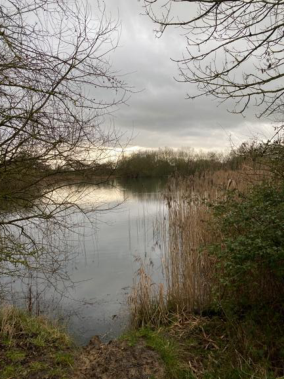
Water Sites: River Ter, River Chelmer, field ponds, drainage ditches & channels
Mood: Lacklustre
A question to walk with
How does the 'private' nature of agricultural land impact the trail's status as a 'shared' asset? How do we navigate the tension between farming and public access?
Having stayed at Saracen’s Head the night before, we set off early after breakfast. This morning, we are joined by Lora’s husband Marley, a filmmaker and their son, little Zeki who is bringing much-needed energy and joy to our grey and muddy walk. As we cross a field out of the small town, we stop to watch a dog splash and swim about frenetically in a pond.
The walk from Great Dunmow to Great Waltham is straightforward, which feels telling. The River Chelmer marks the starting point - a soft edge between civic order and something more ecological. The river appears open, shared, almost permissive. But even here, access is shaped. Bridges dictate crossing points, banks are held in place, and the path quickly redirects you away from the water. What feels natural is, in fact, curated. The walk does not unfold freely; it is routed. Before we reach Dunmow bypass, we say goodbye to Marley and Zeki.
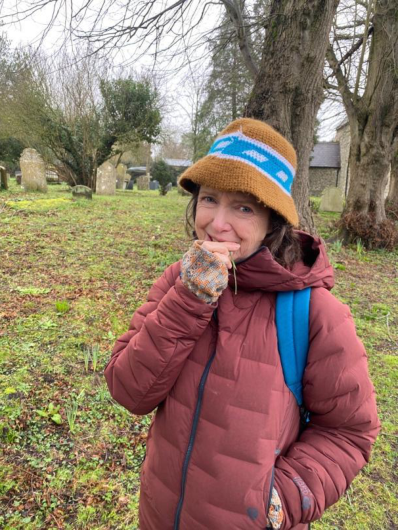
The stretch is quiet. We cross fields and chat as we go, we pick off and eat the last ripe rosehips. Soon we reach Little Dunmow. At the church cemetery, violet flowers appear unexpectedly against the muted tones of early ground. Wild chives carpet graves; we chew on them. We talk about the idea that these plants could be feeding on what lies beneath. That the wild chives might be growing from bodies, from the buried past. The thought lingers. Lichen and moss spread across gravestones, softening their edges, obscuring names. The boundary between human history and natural process feels thin here. Growth and decay are not opposites but continuations.
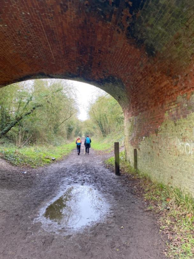
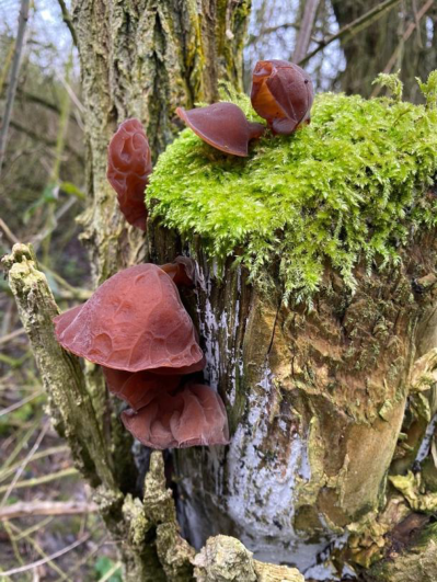
We continue walking, through narrow corridors separating private land. Soon the route joins the Flitch Way, a disused railway line that offers a brief moment of clarity. The path widens, flattens, and becomes legible in a way that the surrounding farmland is not. Nearby, oak trees stand heavy and rooted, their trunks marked with jelly ear mushrooms - dark, soft forms clinging to bark like residual memory. Everything feels layered, as though the ground holds more than it reveals. Movement here feels legitimate - unquestioned. This is infrastructure that was designed for passage, and even in its afterlife as a walking route, it retains that sense of openness. But the relief is temporary. The trail borrows this space; it does not belong to it.
There is a sense of disquiet. Litter gathers in hedgerows. The distant presence of travellers - unseen but suggested through makeshift traces - adds to the feeling of a landscape in partial use, or perhaps contested use. Dogs bark from behind fences we can never quite see, their noise carrying further than their bodies. Several times, there is an instinct to look back along the path, as if to check whether something - or someone - has followed. Nothing has, but the feeling persists.
I wonder about the travellers’ communities’ way of life and their connection to land. In the Essex Records Office, I listened to oral histories from women belonging to travelling communities of picking fruit and making pegs.
In the flat, open fields of Essex, the year turned with the crops, and Traveller families moved with it. When the sugar beet was ready, they came in groups - men, women, and children - bent low over the earth, lifting and topping the heavy roots, their hands roughened by soil and steel. Later came the potatoes, turned up in long ridges, gathered by hand into sacks that grew heavier with each row. The work was steady, paid by what you could finish, not the hours you spent, and it bound whole families together in rhythm with the land.
Through spring and summer they followed what was needed: picking fruit, pulling peas, helping with the hay when it had to be cut and turned before the weather broke. Some seasons took them further afield, but Essex fields called them back year after year, where farmers knew their skill and relied on their return. It was a life shaped by movement and labour, by the weight of crops and the changing sky - hard, uncertain, but woven deeply into the land they worked.
Yet, for all their labour, they were rarely welcomed. At the edges of villages, camps were watched with suspicion, and families were moved on as soon as the work was done. They worked the land but it did not belong to them, their presence tolerated only in season and forgotten just as quickly. Doors stayed closed, voices lowered, and even as their hands filled the harvest, they remained apart - necessary, but never accepted.
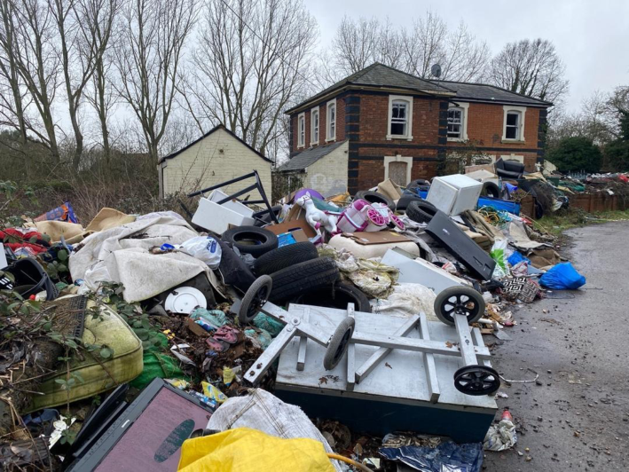
Further on, we pass the derelict Felsted train station, it’s choked with fly-tipping - dirty mattresses, slashed tyres, unicorns and race cars. As we cross the road and join the path, the new build sustainable speak, quietly but unmistakably, to wealth and the sharp edge of inequality.
The route turns towards affluent Felsted. The path cuts diagonally across open farmland, but there is nothing intuitive about this movement. Without waymarkers or a mapped route, this would feel like trespass. The ground is uneven, and the stiles that punctuate entry and exit points are often unstable - wonky, slightly off-balance, as though resisting the idea of easy passage. Each crossing becomes a small negotiation.
We pass along Bakers Lane, Jollyboys Lane, Cobbler’s Green. As the walk continues, signs of wealth begin to surface more clearly. Felsted School emerges as a marker of institutional presence - its scale and architecture distinct from the surrounding farmland. It introduces a different register of land use: one tied not to education, privilege, and long-standing structures of access. The contrast is stark. Earlier, the land felt controlled but functional; here, it feels curated and exclusive. Our conversations turn toward wealth disparity - how land is owned, used, and accessed differently depending on its purpose. The walk itself begins to feel like a thread moving through these inequalities, connecting spaces that are otherwise separate. There is no single landscape here, only a sequence of regimes.
As we leave Felsted, the landscape shifts again. The route edges into parkland associated with old estates near Felsted - land that feels open but is carefully composed. This is not wild openness but aesthetic openness: managed grass, scattered trees, and water features that hint at historic design rather than ecological process. Near the edges of estates like Leez Priory, drainage channels and old fishponds appear - remnants of a landscape once engineered for display and control.
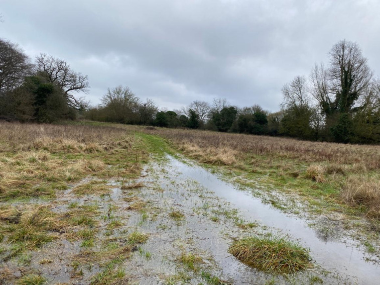
The route then commits fully to farmland. The fields are large, open, and economically active, even in their apparent stillness. The path cuts across them in long diagonals, often without visible tracks. This is where the walk becomes a slog. The ground is heavy in places, and progress feels slow. The earlier unease gives way to fatigue.
Near Ford End, the fields become smaller and more enclosed. Stiles appear more frequently, each one slightly unstable, reinforcing the physical effort required to continue. Even in the absence of livestock, signs warn of their presence. The infrastructure mediates every movement: open, close, step, balance. Walking is no longer fluid; it is interrupted, segmented.
The final stretch toward Great Waltham softens. The rigid geometry of farmland gives way to smaller plots, residential edges, and a loosening of boundaries. The sense of trespass fades, replaced by something more familiar- streets, houses, spaces where walking feels expected rather than permitted.
The walk ends in Great Waltham, where shared space feels unquestioned again. But the experience of getting there lingers. It’s getting dark and the rain is getting heavier. We have tea at the Rose and Crown.
This walk is not defined by scenic moments or dramatic shifts. It is, as it felt throughout, a slog - slow, uneven, and at times uncomfortable. But in that slowness, something becomes visible. The landscape is not continuous; it is stitched together from different forms of ownership, use, and control. The path is not a space in itself but a line negotiated through others.
Looking back, the details remain: the barking dogs you never see, the litter caught in hedges, the unstable stiles, the flooded river, the quiet presence of wild chives and moss-covered stone. Each element contributes to a sense that the land is layered, uneven, and never fully shared.
And perhaps that is the point. This is not a walk through open countryside, but through a series of permissions - temporary, partial, and always subject to the ground beneath your feet.